onX Offroad: Trail Maps & GPS
onXmaps
Downloads
1,000,000+
Version
Latest
Advertisement
Click to download now, finish the installation quickly, and directly unlock the "all-round experience"
Advertisement
Screenshots
Click to download now, finish the installation quickly, and directly unlock the "all-round experience"
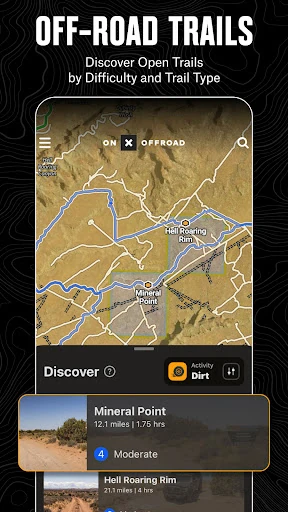
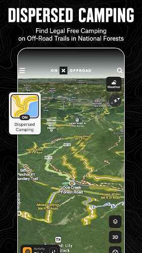
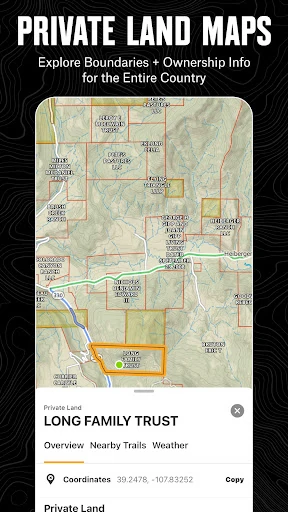
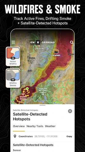
onX Offroad: Trail Maps & GPS has solidified its position as the gold standard for off-pavement navigation in the Google Play ecosystem. Unlike generic mapping tools, it is a specialized utility designed for the rigors of the backcountry. By integrating over 650,000 miles of motorized trails with critical data like land ownership and real-time weather, it provides a level of situational awareness that is indispensable for modern explorers. In the broader Maps & Navigation landscape, onX Offroad stands out by bridging the gap between professional-grade GIS data and consumer-friendly mobile interfaces, making it the premier choice for anyone leaving the tarmac.
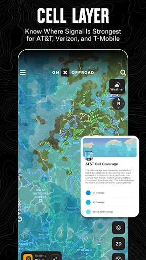
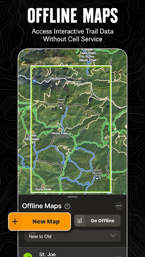
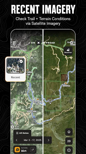
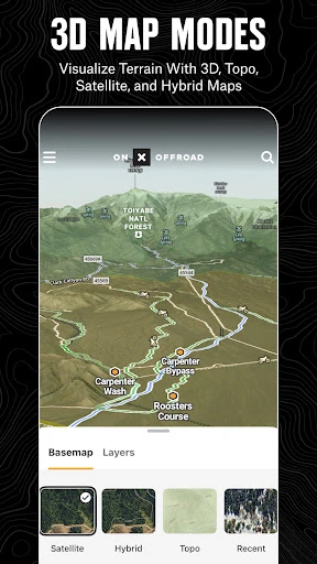
The UI of onX Offroad is remarkably sophisticated yet approachable, considering the density of information it conveys. It utilizes a layered approach to map design, allowing users to toggle complex data points like cell service coverage or property lines without overwhelming the screen. The transition between 2D topographic views and 3D terrain modeling is fluid, providing excellent spatial awareness for navigating steep elevation changes. UX-wise, the "Route Builder" with auto-snap functionality significantly reduces the friction of trip planning, making it feel more like a modern intuitive map and less like a clunky legacy GPS unit.
While the app is robust, the addition of a dedicated "Social Live-Tracking" feature would be a major upgrade, allowing groups of off-roaders to see each other's positions in real-time when within range. Furthermore, more granular alerts for environmental hazards—such as flash flood warnings specifically for canyon regions—would enhance its safety profile for desert explorers. Finally, optimizing the map-tile caching system to reduce the storage footprint on devices with limited memory would improve accessibility for users with older hardware.
onX Offroad: Trail Maps & GPS is a must-have for overlanders, ATV riders, and backcountry explorers who prioritize safety and discovery. It effectively replaces several disparate tools—paper maps, dedicated GPS hardware, and land-use directories—into a single, high-performance mobile application. This app is primarily for the serious off-roader who needs reliable data far beyond the reach of cell towers. Whether you are a casual weekend warrior or a professional expeditionist, onX Offroad is the definitive tool for navigating the wild with confidence.